
Find hidden stories and destinies in the ancient biblical map of Palestine, where every location unveils a piece of history yet to be discovered.
Map of Palestine in the Bible
When you look at the map of ancient Palestine in the Bible, you're not just seeing a collection of names and places. For instance, the journey of Abraham from Ur to Canaan is more than a route; it's a pivotal moment that shaped the destiny of many.
As you explore the historical geography of Palestine, key biblical locations, and the territories of tribes, you'll uncover layers of stories that have influenced not only major battles and events but also the modern interpretation of these ancient maps.
This exploration offers a unique lens through which to view the past, one that might shift your understanding of today's world. Why stop now when each location holds a story waiting to be unraveled?
Key Takeaways
- Biblical maps of Palestine highlight significant locations such as Jerusalem and Bethlehem, central to religious narratives.
- Ancient tribal territories, including those of Judah and Ephraim, provide insights into the societal structure of biblical times.
- Maps depicting David's conquests and Philistine wars illustrate the dynamic political landscape of ancient Palestine.
- Understanding ancient maps aids in grasping the historical and modern implications on religious identities and geopolitical debates.
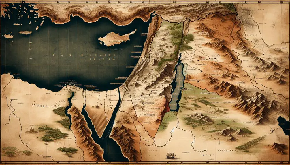
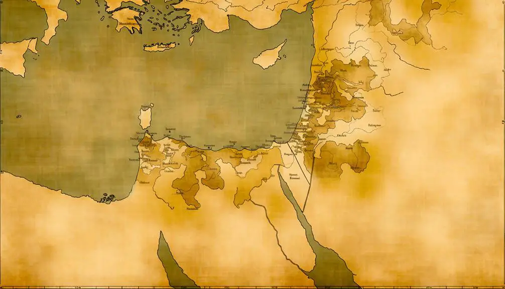
Historical Geography of Palestine
The historical geography of Palestine has significantly shaped its cultural and political landscape, offering insights into the complex interactions between various civilizations over millennia. As you delve into the region's past, you'll find that its position as a crossroads between continents has exposed it to a myriad of influences, both human and climatic. Climate influences, in particular, have played a pivotal role in determining settlement patterns, agricultural practices, and the rise and fall of civilizations within this terrain.
Understanding the historical geography of Palestine requires a deep dive into archaeological methods. These methods, ranging from excavation to analysis of material remains, have uncovered layers of history that tell stories of ancient societies, their innovations, and their adaptations to environmental changes. By examining artifacts, structures, and other archaeological finds, you're able to piece together the puzzle of Palestine's past, revealing how climate and geography have intertwined with human activity.
This scholarly exploration offers a nuanced perspective on how natural features such as the Jordan River Valley, the Dead Sea, and the diverse climatic zones have influenced human settlements and movements. From the earliest nomadic peoples to the complex societies that followed, the land's resources and challenges have been central to its history.
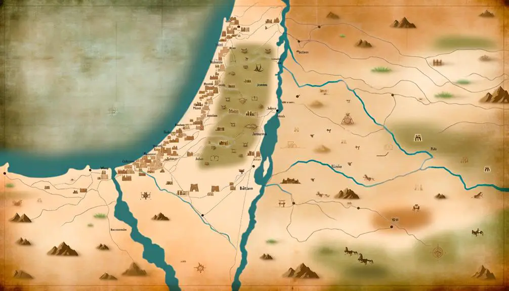
Key Biblical Locations Explored
Having explored the historical geography of Palestine, we now turn our attention to key biblical locations that have profoundly impacted both ancient and modern understandings of this storied land. These places not only hold deep religious significance but are also pivotal in the archaeological discoveries that help us piece together the past.
Jerusalem, for instance, emerges as a central location in both the Old and New Testaments. It's not just the spiritual heart for three major world religions, but archaeological efforts have unearthed layers of history beneath its streets, offering insights into its complex past. Similarly, Bethlehem's mention as the birthplace of Jesus Christ imbues it with profound religious importance, while excavations in the area provide a glimpse into the life during biblical times.
The Sea of Galilee, another significant site, is mentioned numerous times in the New Testament. Modern archaeological finds around this freshwater lake have corroborated historical accounts, reinforcing its importance in Jesus' ministry.
Moreover, places like Jericho and Hebron are rich with archaeological evidence and religious narratives. Jericho, for instance, is one of the oldest inhabited cities in the world, and its walls have been a focal point of archaeological study, shedding light on its destruction mentioned in the Book of Joshua. Hebron, believed to be the burial site of the patriarchs, is another example where religious tradition and archaeological findings intersect, offering a multifaceted view of its significance.
These locations, among others, demonstrate how archaeological discovery and religious tradition interweave, enhancing our understanding of Palestine's biblical landscape.
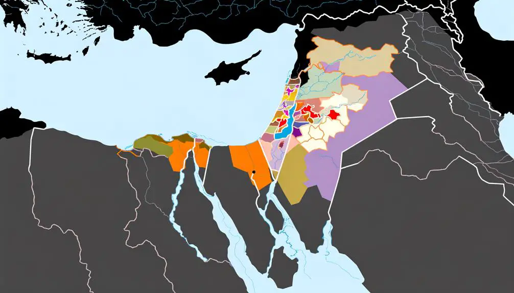
Tribes and Territories
Exploring the distribution of tribes and territories within ancient Palestine reveals a complex tapestry of sociopolitical and religious dynamics that significantly influenced the region's history. You'll find that tribal migrations and the establishment of cultural landmarks were pivotal in shaping the identities and alliances within this ancient landscape.
Tribe |
Territory |
Notable Cultural Landmark |
|---|---|---|
Judah |
Southern region near Jerusalem |
Hebron: Site of the Tomb of the Patriarchs |
Ephraim |
Central region, fertile hills |
Shechem: Center of early Israelite worship |
Manasseh |
Split between the Jordan valley and the west |
Mount Ebal: Site of Joshua's altar |
Benjamin |
Smallest territory, around Jerusalem |
Jericho: Oldest city and first conquest |
Dan |
Coastal plain, later migrated north |
Joppa: Ancient port city |
These territories weren't static; they evolved with the tribal migrations, wars, and diplomatic marriages that characterized the era. Such movements weren't just about political control or economic survival; they were deeply intertwined with religious beliefs and practices. For instance, the relocation of the tribe of Dan is a testament to the dynamic nature of these tribal territories, as it sought more fertile lands to sustain its people.
The landmarks within these territories served as focal points for cultural and religious gatherings, reinforcing tribal identities and the collective memory of the people. Understanding the distribution of tribes and their territories in ancient Palestine, therefore, offers a window into the complex web of relationships that defined this ancient society.
Major Battles and Events
Ancient Palestine's history is marked by pivotal battles and events that shaped its cultural and political landscape. Among these, David's conquests and the Philistine wars stand out as significant episodes that not only defined the era but also the trajectory of the region's development.
David's conquests, in particular, illustrate a period of expansion and consolidation for the Israelite kingdom. You'll find that these military campaigns weren't merely about territorial acquisition; they were also deeply intertwined with the establishment of Jerusalem as a political and religious center. David's strategic victories over neighboring tribes and kingdoms, including the Jebusites in Jerusalem, laid the groundwork for the united monarchy and a centralized form of governance.
On the other hand, the Philistine wars represent a series of conflicts that were crucial in defining the early boundaries and identity of Israel. These wars weren't isolated incidents but part of a prolonged struggle between the Israelites and the Philistines, a struggle that highlighted the volatility of the region's political landscape. The confrontation between David and Goliath, as part of these wars, isn't just a tale of individual heroism but a reflection of the broader conflict between these two powers.
Analyzing these events, you can see that they were instrumental in shaping the social, political, and religious contours of ancient Palestine. The outcomes of David's conquests and the Philistine wars had lasting impacts, influencing the region's historical trajectory for centuries to come.
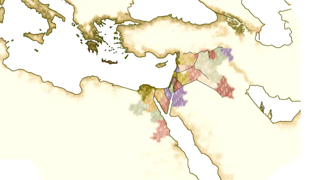
Modern Implications of Ancient Maps
The examination of ancient maps reveals their profound impact on contemporary understandings of Palestine's historical and geopolitical boundaries. These maps aren't just historical artifacts; they're living documents that continue to influence modern views on political boundaries and religious identity. As you delve into this topic, consider the following points:
- Ancient maps of Palestine serve as a basis for understanding the historical claims and roots of various religious and ethnic groups in the region, influencing their sense of religious identity.
- The depiction of boundaries on these maps often fuels debates over political boundaries today, with different groups using them to support their claims to land.
- Modern geopolitical strategies sometimes reference these ancient maps, attempting to justify contemporary territorial claims and policies.
- The influence of ancient maps extends into legal spheres, where they're occasionally cited in arguments regarding international law and the rights of states and peoples.
- Educational materials and media representations that draw on these ancient maps shape public perceptions and narratives about the region, affecting how people understand the current conflict and its origins.
Understanding the implications of ancient maps requires a careful analysis of how historical perceptions have been projected onto modern political and religious conflicts. It's crucial to recognize the power of these maps not just as historical documents but as tools that continue to shape perceptions, policies, and even the physical landscape of Palestine and its surrounding regions.
Frequently Asked Questions
How Do Modern Archaeological Discoveries Align With the Biblical Map of Palestine?
You're diving into how modern archaeological findings correlate with ancient depictions. By comparing ancient scripts and analyzing population migrations, researchers have found significant alignments and discrepancies. Ancient texts, when scrutinized alongside archaeological evidence, reveal fascinating insights.
Population migration analysis, particularly, sheds light on how communities moved and settled, offering a more nuanced understanding of historical narratives. This approach enriches your grasp of the ancient world, blending scholarly investigation with tangible evidence.
In What Ways Have the Perceptions of the Biblical Map of Palestine Changed Due to Technological Advancements in Cartography?
Your understanding of historical geography has evolved significantly thanks to technological advancements in cartography. Digital reconstruction tools have allowed for a more precise depiction of ancient landscapes, enhancing map accuracy.
These technological leaps have reshaped your perception, providing a clearer, more detailed view of the past. By integrating these cutting-edge methods, researchers can now offer insights that were once thought impossible, bridging gaps between historical narratives and archaeological evidence.
How Do Different Religious Traditions Interpret the Boundaries and Significant Locations Mentioned in the Bible's Map of Palestine?
Imagine traversing ancient landscapes, where every hilltop and valley carries the weight of centuries of faith. Different religious traditions see these sacred maps through lenses tinted with their own unique religious symbolism.
In interfaith dialogues, interpretations of boundaries and significant locations diverge, reflecting deep-rooted beliefs and historical narratives. Analyzing these perspectives offers a scholarly glimpse into how sacred texts shape our understanding of a land revered by many.
What Role Do Climate and Environmental Changes Play in the Discrepancies Between the Biblical Map of Palestine and the Current Geographical Layout?
Climate and environmental changes significantly impact the discrepancies between historic and current geographical layouts.
You'll find that oceanic exploration and urban development have altered landscapes, thereby shifting boundaries and redefining significant locations.
These transformations, driven by natural phenomena and human activity, account for variations when comparing ancient descriptions with today's maps.
Understanding these changes is crucial for accurately interpreting historical contexts and their evolution over time.
How Has the Depiction of the Biblical Map of Palestine in Art and Literature Influenced Contemporary Understanding and Interest in Biblical History?
The depiction of the biblical map of Palestine in art and literature, through artistic license and literary symbolism, significantly shapes your contemporary understanding and interest in biblical history.
Artists and writers often embellish or adapt these maps to convey deeper meanings or themes, influencing how you perceive and engage with biblical narratives today.
This creative interpretation not only makes the history more accessible but also enriches your appreciation of the cultural and historical context.
Conclusion
So, after wandering through the labyrinth of ancient maps, dissecting the whereabouts of biblical tribes, and tiptoeing around the minefield of historical and modern implications, you've finally reached the end.
You're now armed with the knowledge that geography isn't just about places; it's about politics, power, and the never-ending human drama. Congratulations, you've navigated the treacherous terrain of Palestine's map – a feat that makes finding your way through rush-hour traffic seem like child's play.
Remember, in the grand scheme of things, it's all about perspective.


Sign up